A 6.2-Magnitude Earthquake Hits China's Qinghai Province
| Charissa Echavez | | Oct 17, 2016 06:46 PM EDT |
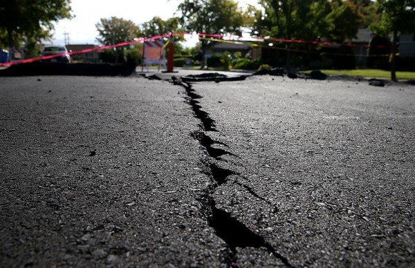
(Photo : Getty Images) A crack runs down the center of an earthquake-damaged street on August 26, 2014 in Napa, California.
A 6.2-magnitude earthquake hit Zadoi Country of Yushu Tibetan Autonomous Prefecture in China's Qinghai Province on Monday afternoon, state-backed Xinhua News agency reported citing the China Earthquake Networks Center.
The epicenter of the earthquake, which struck at 3:14 p.m. (Beijing time), has a depth of 9 kilometers. It was monitored at 32.81 degrees north latitude and 94.93 degrees east longitude.
Like Us on Facebook
The US Geological Survey said the quake hit a depth of 32 kilometers, about 300 kilometers northwest of the city of Qamdo, the Independent noted.
It is located high on the Qinghai-Tibet plateau at an altitude of 4,700 meters and is "extremely sparsely populated" in a radius of 20 kilometers, according to South China Morning Post. Around 12,000 people reside within 50-kilometer radius of the epicenter.
Preliminary measurement reveals it was a 6.3-magnitude quake.
While the strong tremors were felt up to 36 kilometers away, there were no immediate reports of casualties or building collapses. Local authorities are also investigating the extent of the damage caused by the quake.
CCTV reported that schools across Zaboi were suspended and students were immediately evacuated.
After the first quake, a series of aftershocks followed to the affected area, with the strongest recorded at 4.2. As of 7:00 p.m. (Beijing time), at least 155 aftershocks have been recorded, Xinhua noted.
Following the 6.2-magnitude quake, the China Earthquake Administration activated the level-III emergency response procedures. It has dispatched teams to help.
Meanwhile, the Himalaya region is considered as one of the most seismically hazardous regions on Earth, RT noted. Its high seismicity is likely due to the continental collision of the Indian and Eurasian plates.
The Tibetan Plateau, which lies in the northern part of the Himalaya, expands nearly 1,000 kilometers north to south and 2,500 kilometers east to west. It is also geologically and tectonically complex.
Tagsearthquake today, earthquake china 2016, 6.2 magnitude earthquake, tibet earthquake, himalayan earthquake, earthquake
©2015 Chinatopix All rights reserved. Do not reproduce without permission
EDITOR'S PICKS
-

Did the Trump administration just announce plans for a trade war with ‘hostile’ China and Russia?
-

US Senate passes Taiwan travel bill slammed by China
-

As Yan Sihong’s family grieves, here are other Chinese students who went missing abroad. Some have never been found
-

Beijing blasts Western critics who ‘smear China’ with the term sharp power
-

China Envoy Seeks to Defuse Tensions With U.S. as a Trade War Brews
-

Singapore's Deputy PM Provides Bitcoin Vote of Confidence Amid China's Blanket Bans
-

China warns investors over risks in overseas virtual currency trading
-

Chinese government most trustworthy: survey
-

Kashima Antlers On Course For Back-To-Back Titles
MOST POPULAR
LATEST NEWS
Zhou Yongkang: China's Former Security Chief Sentenced to Life in Prison

China's former Chief of the Ministry of Public Security, Zhou Yongkang, has been given a life sentence after he was found guilty of abusing his office, bribery and deliberately ... Full Article
TRENDING STORY

China Pork Prices Expected to Stabilize As The Supplies Recover

Elephone P9000 Smartphone is now on Sale on Amazon India

There's a Big Chance Cliffhangers Won't Still Be Resolved When Grey's Anatomy Season 13 Returns

Supreme Court Ruled on Samsung vs Apple Dispute for Patent Infringement

Microsoft Surface Pro 5 Rumors and Release Date: What is the Latest?


