Apple to Use Drones to Improve Maps Data
| Ellie Froilan | | Dec 02, 2016 01:45 AM EST |
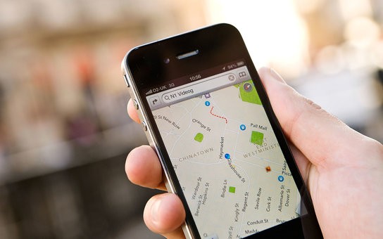
(Photo : Getty Images) Apple Maps will employ drones to update its Maps service by including track road changes, street signs, temporary hazards, and construction.
Apple has announced its plan of using drones to update its maps by adding more accurate data.
The Cupertino-based tech giant has already secured approval from the Federal Aviation Administration (FAA) to use drones in capturing photos, videos, and other traffic data to update map information faster. Apple’s application stated that it would use a wide array of drones from companies like SZ DJI Technology Co. and Aibotix GmbH to collect the data. The company is using 11 types of drones, and it includes three from DJI, aircraft from Parrot's senseFly, and one of Intel’s AscTec Falcon 8 drones.
Like Us on Facebook
The guidelines of the FAA state that the flying drones should be made during daytime and require licensed pilots to operate, keeping the drones to their sight. FAA said that Apple agreed to the guidelines. In addition, Apple can fly the drones in the U.S. within FAA guidelines and fly without restriction in countries without commercial drone regulations.
These drones will be used to capture things such as track road changes, street signs, temporary hazards, and construction. The data could be transmitted back to Apple’s team and will be uploaded to the Apple Maps servers. The drones will replace minivans that Apple is currently using, which feature high-accuracy GPS sensors, cameras, and other equipment.
“There’s a huge data-quality issue there, and I don’t think we initially appreciated all the kinds of technology we would need to do that on an ongoing basis,”Craig Federighi, Apple’s senior vice president of software engineering, said.
Moreover, the iPhone maker is developing new features for Maps. It include images of the inside of buildings and car navigation. The new feature will help users to navigate museums, airports, and other public places. For the car navigation, it will aid in changing lanes while driving.
Tagsapple, Apple Maps, Google Maps, Maps feature, car navigation, drones, FAA, Apple drones
©2015 Chinatopix All rights reserved. Do not reproduce without permission
EDITOR'S PICKS
-

Did the Trump administration just announce plans for a trade war with ‘hostile’ China and Russia?
-

US Senate passes Taiwan travel bill slammed by China
-

As Yan Sihong’s family grieves, here are other Chinese students who went missing abroad. Some have never been found
-

Beijing blasts Western critics who ‘smear China’ with the term sharp power
-

China Envoy Seeks to Defuse Tensions With U.S. as a Trade War Brews
-

Singapore's Deputy PM Provides Bitcoin Vote of Confidence Amid China's Blanket Bans
-

China warns investors over risks in overseas virtual currency trading
-

Chinese government most trustworthy: survey
-

Kashima Antlers On Course For Back-To-Back Titles
MOST POPULAR
LATEST NEWS
Zhou Yongkang: China's Former Security Chief Sentenced to Life in Prison

China's former Chief of the Ministry of Public Security, Zhou Yongkang, has been given a life sentence after he was found guilty of abusing his office, bribery and deliberately ... Full Article
TRENDING STORY

China Pork Prices Expected to Stabilize As The Supplies Recover

Elephone P9000 Smartphone is now on Sale on Amazon India

There's a Big Chance Cliffhangers Won't Still Be Resolved When Grey's Anatomy Season 13 Returns

Supreme Court Ruled on Samsung vs Apple Dispute for Patent Infringement

Microsoft Surface Pro 5 Rumors and Release Date: What is the Latest?


