China Completes First National Geoinformation Survey
| Prei Dy | | Apr 26, 2017 01:54 AM EDT |
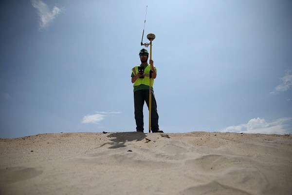
(Photo : Getty Images) China has finally completed and released its first geoinformation survey that covers both natural resources and man-made construction.
China has completed its first national geoinformation survey, which collects basic information on the country's natural resources including location, range, and area, and man-made construction like roads and neighborhoods.-
Based on the 770-terabyte data gathered, China has a total of 7.56 million square kilometers of vegetation cover, while infrastructures occupy 153,000 square kilometers of land, the State Council Information Office said during a press briefing on Monday.
Like Us on Facebook
The survey began in January 2013 and lasted for three years. Remote sensing satellites, drones, and 3D laser scanning were used to obtain the data that covers 92 percent of the country with the help of more than 50,000 people.
"Based on the results, making the most of the statistics is key," Li Weisen, deputy director of the National Administration of Survey, Mapping, and Geoinformation, said.
Before officially releasing, the results underwent months of analysis and approvals for publication were sought. Trained and certified personnel used aerial photography and on-site verification to provide the most accurate information and produce the quality of the survey. The precision is supposed to 99.7 percent, with resolution of one meter.
"The specific numbers help local authorities make more precise decisions to solve the problems," Cheng Pengfei, president of the Chinese Academy of Surveying and Mapping, said.
Meanwhile, the data are expected to be used in streamlining regulations, precision targeting of poverty alleviation measures, real estate registration, control of illegal construction, pollution tracking, to name a few. In Beijing, Hebei, and Tianjing, for instance, surveyors concentrated on monitoring the sources of air pollution and expansion of urban areas.
The recent results will be available to public departments to allow them to improve services.
Tagschina, man-made construction, natural resources, geoinformation survey
©2015 Chinatopix All rights reserved. Do not reproduce without permission
EDITOR'S PICKS
-

Did the Trump administration just announce plans for a trade war with ‘hostile’ China and Russia?
-

US Senate passes Taiwan travel bill slammed by China
-

As Yan Sihong’s family grieves, here are other Chinese students who went missing abroad. Some have never been found
-

Beijing blasts Western critics who ‘smear China’ with the term sharp power
-

China Envoy Seeks to Defuse Tensions With U.S. as a Trade War Brews
-

Singapore's Deputy PM Provides Bitcoin Vote of Confidence Amid China's Blanket Bans
-

China warns investors over risks in overseas virtual currency trading
-

Chinese government most trustworthy: survey
-

Kashima Antlers On Course For Back-To-Back Titles
MOST POPULAR
LATEST NEWS
Zhou Yongkang: China's Former Security Chief Sentenced to Life in Prison

China's former Chief of the Ministry of Public Security, Zhou Yongkang, has been given a life sentence after he was found guilty of abusing his office, bribery and deliberately ... Full Article
TRENDING STORY

China Pork Prices Expected to Stabilize As The Supplies Recover

Elephone P9000 Smartphone is now on Sale on Amazon India

There's a Big Chance Cliffhangers Won't Still Be Resolved When Grey's Anatomy Season 13 Returns

Supreme Court Ruled on Samsung vs Apple Dispute for Patent Infringement

Microsoft Surface Pro 5 Rumors and Release Date: What is the Latest?


